Log in
All resources
Create a design
62 Free Artworks of Maps Of The Holy Roman Empire
bibliothèque nationale de france
map of the german empire by louis stanislas d'arcy de la rochette
sanson maps of the circles of germany
david rumsey historical map collection
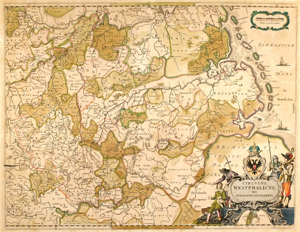
atlas novus (blaeu)
1790s maps of the holy roman empire
maps of the course of the rhine by guillaume sanson
maps by pieter van der keere
thomas kitchin
sanson map of the german empire (17th century)
charles v, holy roman emperor
conquest of tunis (1535)
17th-century maps of lower saxony
atlas novus (blaeu)
old maps of the holy roman empire
maps made in the 18th century
maps of antwerp by braun & hogenberg
maps of antwerp city walls
old maps in the bibliothèque nationale de france
old maps of the holy roman empire
1640s maps of the netherlands
coats of arms on maps
holy roman empire
pierre mortier
1490s maps of the holy roman empire
german renaissance
prints in the staats- und stadtbibliothek augsburg
16th-century maps of augsburg
kingdom of bohemia (1627-1740)
17th-century maps of bohemia
1580s maps of the holy roman empire
copper engravings
17th-century maps of the holy roman empire
maps by pieter van der keere
latin-language maps
german renaissance
maps of the holy roman empire
1767 maps of germany
map of the german empire by louis stanislas d'arcy de la rochette
1782 maps of the holy roman empire
maps showing 18th-century history
maps made in the 18th century
map of the german empire by louis stanislas d'arcy de la rochette
1782 maps of the holy roman empire
daniel friedrich sotzmann
grosser deutscher atlas
maps by willem and johannes blaeu
1640 maps
maps of vienna by braun & hogenberg
vienna in the 1580s
maps by emanuel bowen
1750s maps of germany
1630s maps of the holy roman empire
maps by willem and johannes blaeu
maps by thomas kitchin
1750s maps of germany
maps by thomas kitchin
1750s maps of germany
david rumsey historical map collection
1790s maps of the holy roman empire
bibliothèque nationale de france
guillaume sanson
1700s maps of the holy roman empire
maps by joachim bormeester
sanson map of the german empire (17th century)
sanson maps of the circles of germany
sanson map of the german empire (17th century)
sanson maps of the circles of germany
sanson map of the german empire (17th century)
sanson maps of the circles of germany
sanson map of the german empire (17th century)
sanson maps of the circles of germany
tresor des cartes geographiques (1659)
1650s maps of the holy roman empire
map of the german empire by louis stanislas d'arcy de la rochette
1773 maps of the holy roman empire
1628 maps of germany
maps from gallica
david rumsey historical map collection
1790s maps of the holy roman empire
bibliothèque nationale de france
cartouches by tomas lópez
sanson maps of the circles of germany
bibliothèque nationale de france
sanson maps of the circles of germany
bibliothèque nationale de france
1610s maps of the holy roman empire
jacques surhon
17th-century maps of luxembourg
maps by pieter van der keere
maps by nicolas sanson
1730s maps of france
maps of the course of the rhine by guillaume sanson
robert cordier (engraver)
david rumsey historical map collection
1790s maps of the holy roman empire
maps of the duchy of mantua
guillaume sanson
1794 maps of the holy roman empire
english-language maps of europe
coats of arms on maps
atlas novus (blaeu)
david rumsey historical map collection
old maps of the holy roman empire
l'empire d'allemagne divisé en ses dix cercles, et ces cercles en leurs principaux estats, principautés et souverainetés ecclésiastiques, laiques et villes impériales avecq le royaume de boheme et les... - btv1b53202355w
sanson maps of the circles of germany
maps of the course of the rhine by guillaume sanson
maps by nicolas sanson
1640s maps of the netherlands
maps by nicolaes visscher i
maps of the course of the rhine by guillaume sanson
maps by nicolas sanson
17th-century maps of the holy roman empire
maps by pieter van der keere
maps of the course of the rhine by guillaume sanson
bibliothèque nationale de france
maps of the course of the rhine by guillaume sanson
bibliothèque nationale de france
maps of territories in the burgundian circle
1645 maps of belgium
maps of territories in the burgundian circle
1645 maps of belgium
david rumsey historical map collection
1794 maps of the holy roman empire
david rumsey historical map collection
1790s maps of the holy roman empire
david rumsey historical map collection
1790s maps of the holy roman empire
maps of the course of the rhine by guillaume sanson
bibliothèque nationale de france
l'empire d'allemagne divisé en ses dix cercles en leurs principaux estats. le royaume de bohême et les provinces qui en dépendent - nouvellement reveu et corrigé par le sieur sanson... ; lud. cordier... - btv1b532023318
sanson maps of the circles of germany
pieter verbiest (ii)
maps from gallica
1 - 62 of 62
/ 1